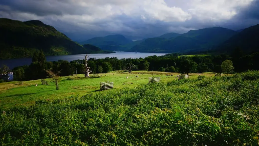
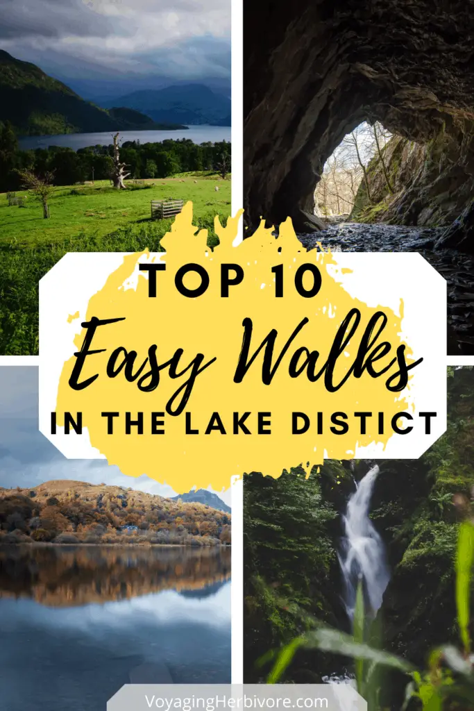
Sometimes you just don’t want to spend your Lake District holiday sweating and swearing as you try to find your inner mountain goat. That’s why we put together this guide to the best easy walks in the Lake District.
In this guide you’ll find waterfalls, pubs, tarns, wild swimming opportunities, and more importantly, some of the most beautiful views in the world (I’m not biased, I promise).
Keep reading to discover 10 easy Lake District hikes!
Table of contents
- What’s a circular and what does it have to do with easy Lake District walks?
- Tarn Hows Circular
- Tom Gill Waterfall Circular (Option to Add Tarn Hows)
- Stock Ghyll Force Waterfall
- Aira Force Waterfall Circular
- Rydal Water Circular
- Rydal Cave
- Grasmere Lake Circular
- Orrest Head Circular
- Barrowfell Circular
- Glenridding and Greenside Mine Circular
- Planning Your Easy Lake District Hikes
- More Lake District Guides
- Follow Us on Pinterest
What’s a circular and what does it have to do with easy Lake District walks?
A circular (also known as a loop) is a walk that takes you back to the same point you started at via a different direction. Short circular walks in the Lake District mean that you don’t have to worry about catching a bus back or being anywhere at a certain time. The Lake District hikes on this list that aren’t listed as “circular” mean that you have to go back the same way you came, however there are only two, and they’re both very short (15 minutes max). Happy trails!
Leave No Trace
Stay on designated trails. Take your trash back home with you.
Take nothing but pictures and leave nothing but footprints!
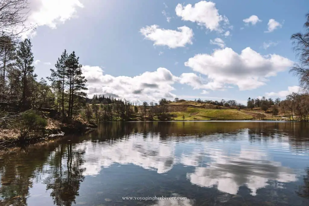
Tarn Hows Circular
Tarn Hows Location: Slightly west of Lake Windermere and north of Coniston Water
Tarn Hows Distance: 2.9 km (1.8 miles)
Tarn Hows Elevation: 154 m (505 ft)
Time to Walk Tarn Hows: About an hour at an easy pace
Where to Park for Tarn Hows: Variety of road parking around. Let your GPS take you to Tarn Hows and you’ll see a small parking lot with a great view. Park here if there’s space but if not continue down to another parking lot.
Map and Directions
What’s so great about this easy Lake District walk: The Tarn Hows loop is one of the easiest but probably most beautiful walks in the Lake District. The peaceful area is filled with incredible views for very little effort and with so many trees and little peninsulas, it’s easy to find a quiet spot to take a wild swim or have a picnic. There are plenty of benches along the way so if anyone needs to stop and take a breather, Tarn Hows is also a great starting point for a variety of other walks in case you want to extend your day out.
Tom Gill Waterfall Circular (Option to Add Tarn Hows)
Tom Gill Location: Connects with Tarn Hows to the west
Tom Gill Distance: 1.6 km (0.99 miles)
Tom Gill Elevation: 104 m (341 ft)
Time to Walk Tom Gill: 45 min (but account for longer if you’ll want to stop for pictures)
Where to Park for the Tom Gill Waterfall Circular: Glen Mary Bridge Car Park (if you have a National Trust membership it’s free to park for the day)
Map and Directions
What’s so great about this easy Lake District walk: The Lake District is full of great waterfalls, but if you’re looking for a short and relatively easy trail that offers several waterfall options, the Tom Gill Waterfall circular can’t be beaten. Since it’s just off of Tarn Hows, if you want about 2 hours of easy walks and a chance to take a paddle, start at Glen Mary Bridge Car Park, follow the path past the waterfalls, and continue walking around Tarn Hows.
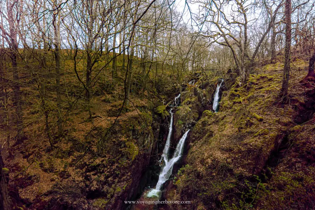
Stock Ghyll Force Waterfall
- Stock Ghyll Force Location: About a 15-minute walk outside of Ambleside
- Stock Ghyll Force Distance: 1.7 km (1.1 miles)
- Stock Ghyll Force Elevation: 79 m (262 ft)
- Time to Walk Stock Ghyll Force: 10 to 20 minutes
- Where to Park for Stock Ghyll Force Waterfall: Many towns in the Lake District operate on a disk system for street parking. This means that you display your arrival time, and usually need to be back within an hour or two (the signs on the street should say “Disk Zone” and how long you can stay. You can either write your time of arrival on a piece of paper and place it on your dashboard, or you can get a free disk from many local shops. More details available here. There is a disk zone just a few minutes walk from the entrance to Stock Ghyll Force, just drive along the road until you see it signposted. Alternatively, you can park in Ambleside and walk to the waterfall.
- Map and Directions
@voyagingherbivore Stock Ghyll Force is one of the tallest #waterfalls in the #LakeDistrict. It’s only a 15-minute walk outside of #Ambleside! #uktravel ♬ original sound – Alysa
What’s so great about this easy Lake District walk: With 70 feet of cascading water, Stock Ghyll Force is probably the tallest waterfall in the lakes that you can access for the least effort. You don’t actually need to walk up to the top as about halfway up are several viewing platforms that give the best view. Because it’s so easy to access, Stock Ghyll Force can get busy so it’s best to arrive early. Keep in mind though that this walk is fairly vertical and is not stroller friendly.
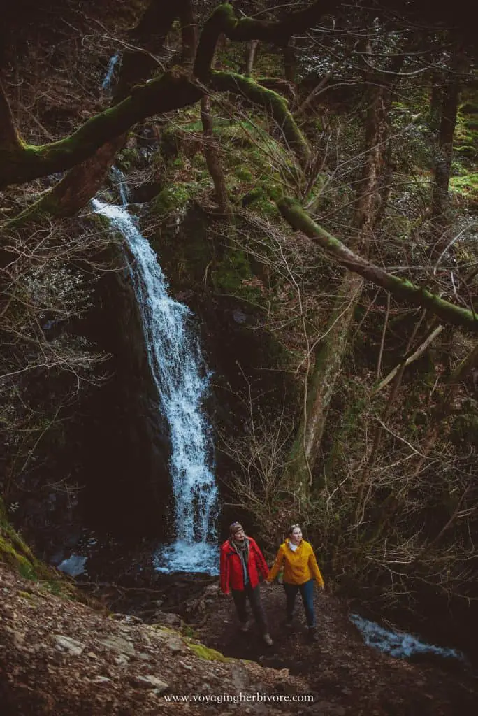
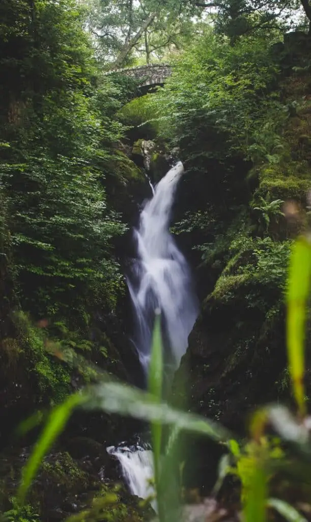
Aira Force Waterfall Circular
Aira Force Waterfall Location: Northern Lakes near Ullswater
Aira Force Waterfall Circular Distance: 2 km (1.3 m)
Aira Force Waterfall Elevation: 138 m (456 ft)
Time to Walk Aira Force Waterfall Circular: 1.5 to 2 hours due to elevation but likely less
Where to Park for Aira Force Waterfall Circular: Aira Force Carpark which is a National Trust car park. If you have a National Trust membership, it’s free to park for the day.
Map and Directions (Including High Force)
What’s so great about this easy Lake District walk: This relatively easy Lake District walk provides massive rewards with an impressive view of the impressive 65-foot waterfall. If you’re looking to extend your walk, continue walking to High Force Waterfall, often dubbed one of the most impressive waterfalls in England – you don’t want to wild swim near this!
Rydal Water Circular
Rydal Water Circular Location: Between Grasmere and Ambleside just north of Lake Windermere
Rydal Water Circular Distance: 4.5 km (2.8 miles)
Rydal Water Circular Elevation: 204 m (672 ft)
Time to Walk Rydal Water Circular: 2.5 hours
Where to Park for Rydal Water Circular: White Moss Car Park or Pelter Bridge Car Park (cheaper but smaller and fills up very quickly)
Map and Directions
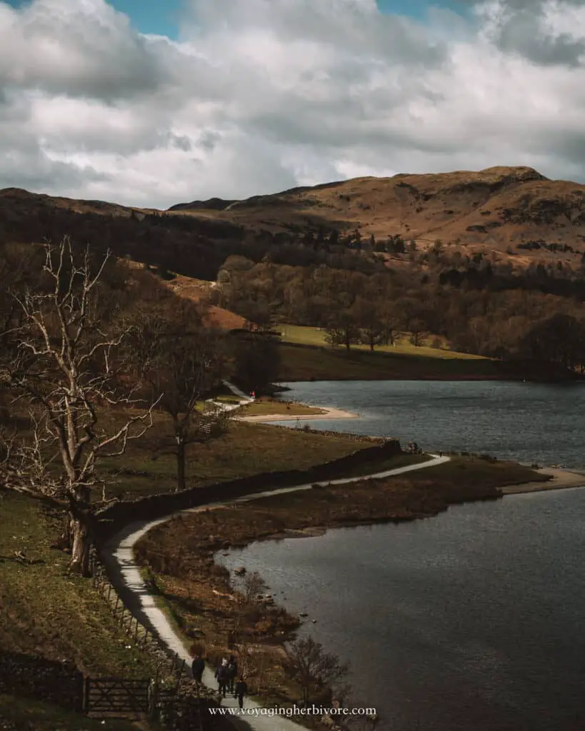
What’s so great about this easy Lake District walk: This easy walk along mostly paved paths makes for a perfect end to your Lake District adventures. The route is popular with families and those looking for an easier walk so it does get busy.
You can also take an easy detour to access Rydal Cave, a must-visit attraction in the Lake District. The Rydal Water circular offers plenty of amazing views of Rydal Water and the surrounding areas. Because it’s located between Grasmere and Ambleside, it’s easy to extend your walk into either (or both) of the two towns. If you are taking a longer walk, be sure to bring your Grayl water purifier bottle to refill in Rydal Water.
Rydal Cave
Rydal Cave Location: North of Ambleside and south of Rydal Water
Rydal Cave Walk Distance: From Pelter Bridge Car Park 1.1 km (0.7 miles)
Rydal Cave Elevation from Rydal Water: 120m (393 ft) (estimated based off of Google Maps)
Time to Walk to Rydal Cave: From Pelter Bridge Car Park about 15 minutes, from White Moss Car Park about 20 minutes
Where to Park for Rydal Cave: Pelter Bridge Car Park is cheaper and closer but it fills up very quickly. White Moss Car Park is the alternative option and is much bigger but slightly more expensive. Both car parks take contactless payment.
Map and Directions
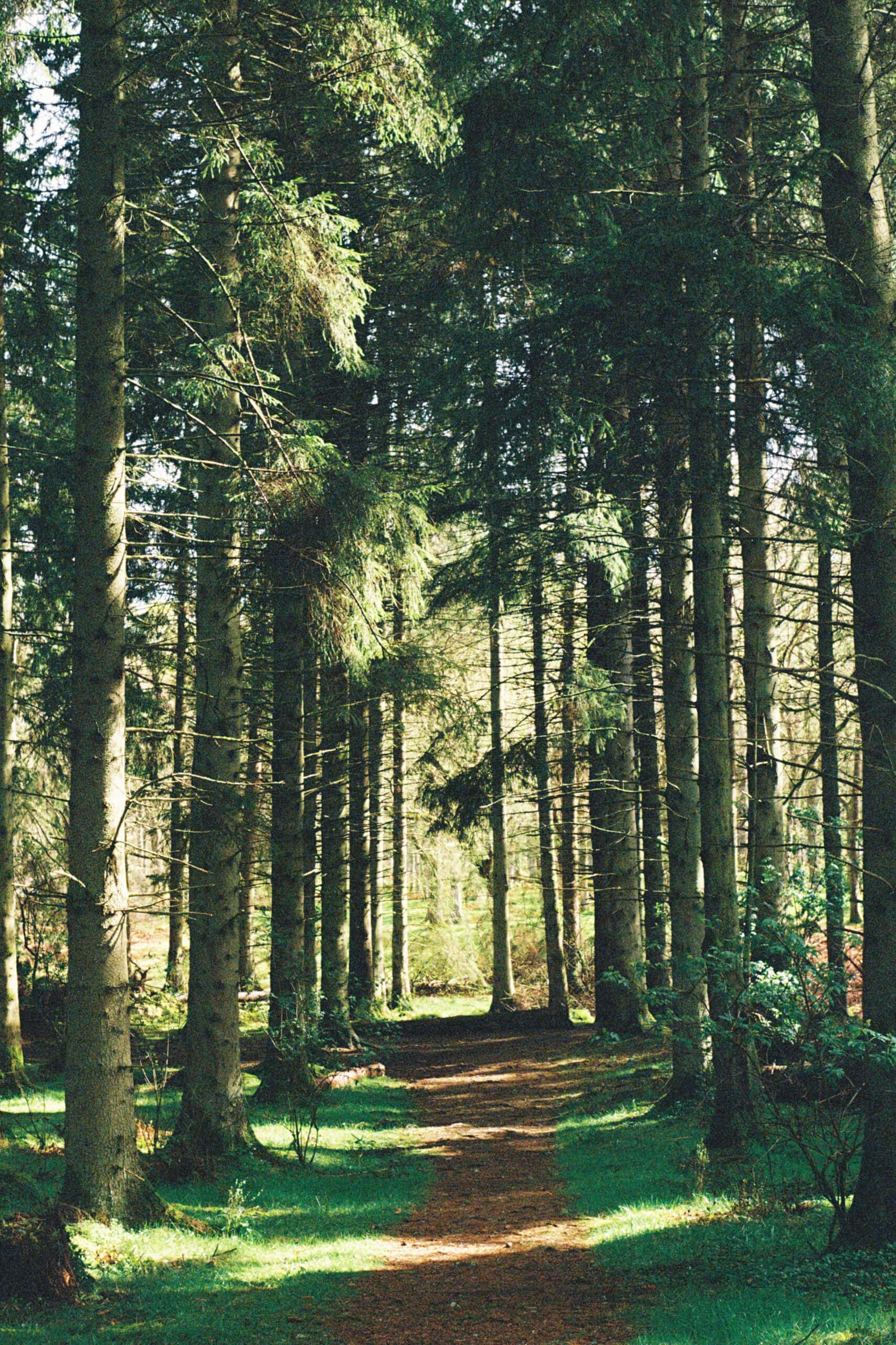
What’s so great about this easy Lake District walk: Rydal Cave is a fantastic place to explore and is very easy to find. Just a short walk from two car parks, the view past Rydal Water and up through the forest provides spectacular views. Keep in mind that accessing Rydal Cave (the actual cavern) isn’t the easiest, but it can still be easily viewed. Check out the video below to see how we had to get in.
Read More: Don’t Make This Mistake When Visiting Rydal Cave
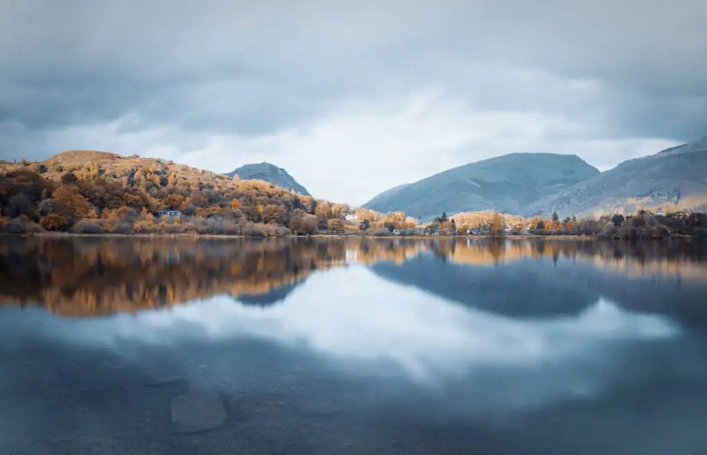
Grasmere Lake Circular
Grasmere Lake Circular Location: Grasmere
Grasmere Lake Circular Distance: 5.6 km (3.7 miles)
Grasmere Lake Circular Elevation: 770 ft (avoid this by going to the south of White Moss commons instead of the north)
Time to Walk Grasmere Lake Circular: About 2 hours
Where to Park for the Grasmere Lake Circular: Anywhere in the Grasmere town
Map and Directions
What’s so great about this easy Lake District walk: With great views and plenty of seating, the Grasmere Lake loop is not to be missed. Not only will you get to see the gorgeous landscapes, but the walk takes you through some absolutely stunning villages. You’ll be ready to move to the lakes permenantly!
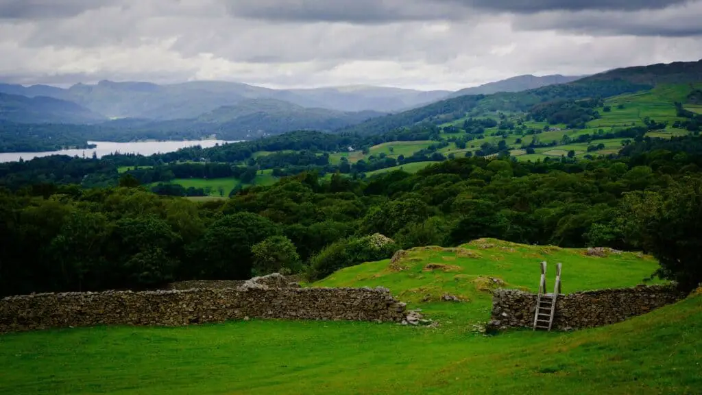
Orrest Head Circular
Orrest Head Circular Location: West side of Lake Windermere
Orrest Head Circular Distance: 4.5 km (2.8 miles)
Orrest Head Circular Elevation: 159 m (524 ft)
Time to Walk Orrest Head Circular: 1.5 hours
Where to Park for Orrest Head: Windermere train station or street parking near there
Map and Directions
What’s so great about this easy Lake District walk: Located near the very touristy area of Bowness, Orrest Head is a relatively easy walk with great views and, if you get there early enough you might just have the place to yourself. While there are many great viewpoints of Lake Windermere the Orrest Head viewpoint is surely one of the most rewarding the least efforts.
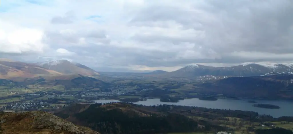
Barrowfell Circular
Barrowfell Circular Location: Keswick
Barrowfell Circular Distance: 4.5 km (2.8 miles)
Barrowfell Circular Elevation: 312 m (1026 ft)
Barrowfell Circular Time to Walk: 1.5 hours
Where to Park for Barrowfell Circular: Anywhere in Braithwaite village
Map and Directions
What’s so great about this easy Lake District walk: If you’ve ever wanted to make people think that you have a drone, Barrowfell Circular has you covered! With beautiful views, gorgeous streams, and limited effort required, Barrowfell Circular is a Lake District hike that you don’t want to miss.
Glenridding and Greenside Mine Circular
Glenridding and Greenside Mine Circular Location: Glenridding, Cumbria
Glenridding and Greenside Mine Circular Distance: 5.5km (3.4 miles)
Glenridding and Greenside Mine Circular Elevation: 204 m (669 ft)
Time to Walk Glenridding and Greenside Mine Circular: 1.5 hours
What’s so great about this easy Lake District walk: This gorgeous walk has it all: waterfalls, pubs, and insane views! It takes about an hour and a half to walk, but of course, if you stop for lots of photos or bring a picnic, give yourself plenty of extra time. You’ll follow streams, roads, and well-trodden trails and if you’re feeling extra brave, there are even a few places that you can stop and wild swim!
Lake District Essentials
If you’re heading to the Lake District, you’ll need a waterproof jacket, hiking boots, and a few other essentials like National Trust and English Heritage memberships (they pay for themselves with free parking). Check out our recommendations below.


Stay in the Lake District
Planning Your Easy Lake District Hikes
Keep in mind that at many places in the Lake District you won’t have cell service. We’ve made the mistake of assuming we’ll be able to Google something when we’re there or having a map pulled up only to accidentally refresh the page in an area with no service and have to ask local walkers for directions.
Because of this, I would recommend either purchasing a physical map when you’re in the Lakes (this can be done at virtually any shop) or investing in an app like AllTrails. AllTrails is a fantastic app that can be used to find trails all over the world (not sponsored, I just genuinely love them!). You can use it for free to view maps and routes, however, to download the maps for offline use you do need to have a pro account which is about £30 per year. If you enjoy hiking, it’s definitely worth it! But don’t forget to bring a portable charger because if your phone dies you’re out of luck.
More Lake District Guides
What Camera Gear Do We Use?
- Camera body: Nikon d750
- Phone: iPhone 13 Pro
- Favorite Multipurpose Travel Lens: 24-120mm f/4
- GoPro: GoPro Hero 8
- Drone: DJI Mavic Air is no longer available so we recommend the DJI Air2S
- Camera Bag: Wandrd Prvke 31L
- Tripod: ESDDI Aluminum Tripod
If you want the full list of things we keep in our camera bag, check out the complete guide or browse our photography guides.
Free Resources


And as always, you can find more sustainable travel content on Instagram @VoyagingHerbivore, Youtube, and TikTok and to get updates straight to your inbox, enter your email below.
If you found this guide helpful and want to help us keep these resources free,
please consider making your next Amazon, Expedia, Hostel World, Etsy, Trivago, and Booking.com purchase through our links (just click right on those words – you can do it right now and unless you clear your cookies before your next purchase, it will remember). It costs you no extra and gives us a small commission. Thank you!
Follow Us on Pinterest
Leave a Reply